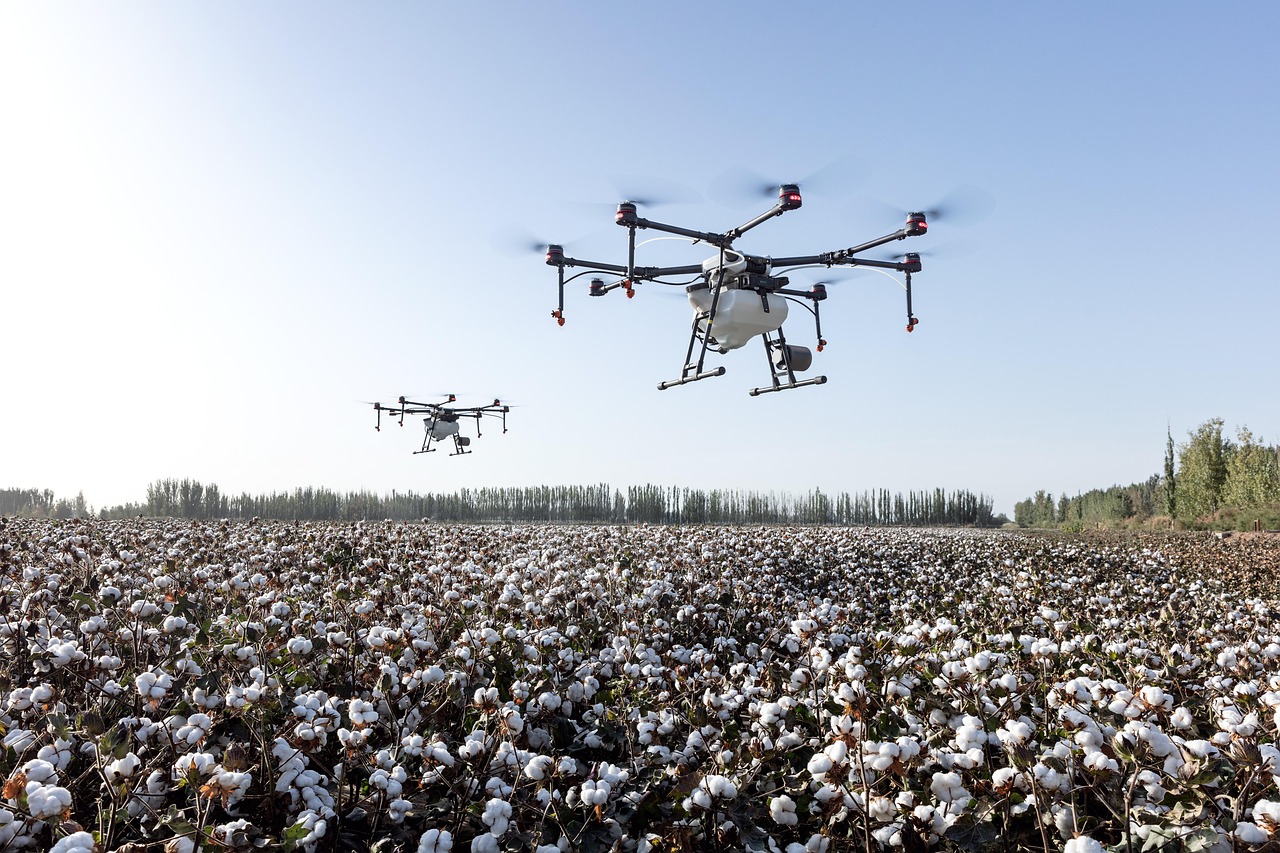
A drone, also known as an unmanned aerial vehicle (UAV), is an unmanned aircraft guided by remote control or onboard computers. Most agricultural drones have either fixed wings or rotors. Drones with four rotors are called quadcopters.
Drone applications in precision agriculture include mapping, surveying, monitoring, planting, crop dusting, and spraying. Drones can increase yields, save time and money, and assist with animal and crop monitoring, planning, and management. The birds-eye-view of a drone can improve production, efficiency, and yields by identifying small problems before they become big problems. Real-time footage can prevent costly losses and ensure the success of the crops.
Drone map creation provides farmers with an accurate view of their fields. Drones equipped with near infrared camera sensors allow the drones to see the spectrum of light that plants use to absorb light for photosynthesis. Using this information, farmers can identify the health of their crop. Drones can create detailed Global Positioning System (GPS) maps for planning the location of planting to maximize land, water, and fertilizer usage.1 Precise soil analysis maps produced by drones help direct seed planting patterns, irrigation, and nitrogen-level management. Nutrients, moisture levels, and overall crop health is monitored in real time by drones equipped with hyper-spectral, multispectral, and thermal sensors. Scanning crops with visible and infrared (IR) light, drones can identify plants infected by bacteria or fungus, helping to prevent diseases from spreading to other crops. This technology enables detection of some diseases before they are visible to the human eye.2
Drone cameras can take high-resolution images with clear detail. Drones equipped with thermal cameras can assist with irrigation decisions by identifying areas of pooling water or insufficient soil moisture. Thermal imaging cameras can also monitor livestock by checking the herd for injured, sick, missing, or birthing livestock. Drones provide greater resolution than satellites or airplanes because they can be flown lower and more precisely.3
Crop spraying drones can carry fertilizer, herbicides, pesticides, or fungicides in large liquid storage reservoirs. Applications using drones are less expensive than manual vehicle applicators or crop dusters. Drones follow pre-mapped flight paths and spray crops with precision and accuracy, which can reduce waste and over spraying.
Drones can be operated by remote control or by onboard computers with a preset flight path. The flight path of a drone is created by the user on a ground control device (a laptop, tablet, or smartphone). The line of flying is drawn on a map, and the information is transferred or uploaded wirelessly from the ground control device to the drone. The drone follows this flight path, and the user has the option to perform manual overrides if necessary.
Drones with rotors, like quadcopters, use the rotors for propulsion and control. A rotor is like a fan. Spinning blades push air down. Two of the rotors diagonally opposite of each other are spinning clockwise while the other two rotors are spinning counterclockwise. According to Newton's third law of motion, for every action there is an equal and opposite reaction, all forces come in pairs. As the rotor pushes down on the air, air pushes up on the rotor. In order for the drone to fly into the air, a force that equals or exceeds the force of gravity must be created. This is called lift. The faster the rotors spin, the greater the lift. Drones can hover, climb, or descend. To hover, the thrust of the rotors pushing the drone up must be equal to the gravitational force pulling it down. By increasing the thrust (speed of the rotors), the upward force is greater than the force of gravity and the drone will climb. By decreasing the thrust, the drone will descend.4
Yaw is the rotating of the drone either clockwise or counterclockwise on a vertical axis. A drone with four rotors can rotate by changing the power to the four rotors. Decreasing the spin of two rotors diagonally opposite from each other and increasing the spin of the other two rotors causes the drone to rotate while hovering.
Pitch is the movement of the drone either up or down on a lateral axis. Moving the front of the drone up requires increasing the rotation rate of the back two rotors and decreasing the rate of the front two rotors. Decreasing the rotation rate of the back two rotors and increasing the rate of the front two rotors will move the front of the drone down.
Roll is the rolling movement of the drone sideways, either to the left or the right, on a longitudinal axis. Increasing the rotation rate of the right two rotors and decreasing the rate of the left two rotors will move the drone to the left. Decreasing the rotation rate of the right two rotors and increasing the rate of the left two rotors will move the drone to the right.
The ascent, descent, yaw, pitch, and roll on most quadcopters can be controlled by the throttle sticks on the remote control or by programming a flight plan.
All drones that weigh more than .55 pounds (250 grams) must be registered with the Federal Aviation Administration (FAA). Unmanned aircraft should stay below 400 feet (122 meters). Everyone flying drones should follow these basic safety guidelines at all times:
- Keep the drone in eyesight at all times, and use an observer to assist if needed.
- Remain well clear of and do not interfere with manned aircraft operations. See and avoid other aircraft and obstacles at all times.
- Do not intentionally fly over unprotected persons or moving vehicles. Remain at least 25 feet (8 meters) away from individuals and vulnerable property.
- Contact the airport and control tower before flying within five miles (8 kilometers) of an airport or heliport.
- Do not fly in adverse weather conditions such as high winds or reduced visibility.
- Do not fly under the influence of alcohol or drugs.
- Ensure that the operating environment is safe and that the operator is competent and proficient in the operation of the drone.
- Do not fly near or over sensitive infrastructure or property such as power stations, water treatment facilities, correctional facilities, heavily traveled roadways, government facilities, etc.
- Check and follow all local laws and ordinances before flying over private property.
- Do not conduct surveillance or photograph persons in areas where there is an expectation of privacy without the individual's permission.5
The FAA mobile app B4UFLY is useful for locating no-fly zones.
Before using drones within an educational setting, consult with district administration to evaluate district and school policies, local regulations, and legal implications. Laws surrounding drone use change frequently. For up-to-date information, go to knowbeforeyoufly.org. Information specific to the educational use of drones can be found on the Know Before You Fly Educational Use webpage. The book Drones in Education by Chris Carnahan, Laura Zieger, and Kimberly Crowley provides recommendations and information about classroom implementation.
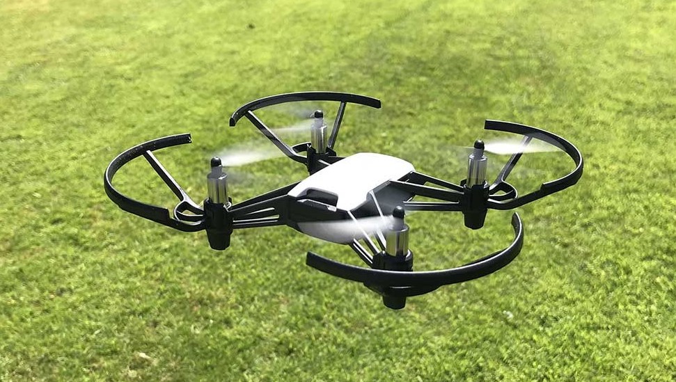
Prior to teaching the Drones in High-Tech Farming lesson, familiarize yourself with flying the Tello drone and programming using the DroneBlocks App. The DroneBlocks App is free and is compatible with most DJI drones including Phantom 3, Phantom 4, Mavic Pro, Mavic Air, Spark, and Tello.